
| Author | Ruggieri, Michele 羅明堅, 1543-1607Lo Sardo, EugenioLume, LucioArchivio di Stato di RomaIstituto poligrafico e Zecca dello Stato (Italy) |
| Place | Roma |
| Publisher | Istituto poligrafico e Zecca dello Stato |
| Collection | Ricci Institute Library |
| Language | Italian, Chinese, Latin |
| Type | Atlas |
| Shelf | Seminar Room 102-103 |
| Call Number | G2305.R84 1993 |
| Description | 1 atlas (ix, 137 p., 80 folded maps) ; 46 cm. |
| Note | Atlante della Cina / di Michele Ruggieri, S.I. ; [riproduzione in fac-simile delle tavole conservate nella Collezione Manoscritti della Biblioteca dell'Archivio di Stato di Roma], a cura di Eugenio Lo Sardo ; Archivio di Stato di Roma ; [Comitato scientifico, Lucio Lume, presidente ... et al.]. Atlante della Cina di Michele Ruggieri 羅明堅, S.J. (1543-1607) "Born in Spinazzola in Puglia (Italy), Ruggieri entered the Society of Jesus at the age of twenty-nine after holding official posts under Philip II, King of Naples. He was assigned to the Eastern missions and arrived in Goa on September 13, 1578. (Matteo Ricci was a fellow passenger). In July 1579 he arrived in Macau to implement the revolutionary missiological policy inaugurated by Alessandro Valignano 範禮安, S.J. (1538-1606). In 1583, after establishing friendly contacts with Chinese officials in Guangdong Province he was granted permission to build a church and residence at Zhaoqing 肇慶. In September of 1583 Ruggieri and Ricci took up residence there, establishing the first post-medieval Christian mission in China. |
| ISBN | 882400380X |
| Multimedia | 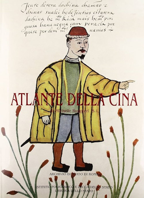 |
| Author | Hondius, Jodocus, 1563-1612 |
| Place | Amsterdam |
| Publisher | [Hondius] |
| Collection | Ricci Institute Library |
| Language | Latin |
| Type | Map, Map (Digital) |
| Shelf | Map Case |
| Call Number | [4] G7810 1606 .H65 |
| Description | 1 hand-colored map ; 36 x 45 cm. |
| Note | China [map] / [Jodocus Hondius] Relief shown pictorially. "Medius Meridianus est 155 reliqui ad hunc inclinantur pro ratione 15 & 58 parallelorum."; Includes illustrations of wheeled wind machine, junk, masted ship, and crucifixion [persecution of Christians in Japan]; Represents Korea as an island, "Corea"; Sea of Korea not labeled.; Map verso has text "Regnum Chinae", p. 354 and 355.; Copper engraving, printed on chain-lined paper. Image at Barry Lawrence Ruderman Antique Maps |
| Multimedia |  |
| Author | Kitchin, Thomas, 1718-1784 |
| Place | London |
| Publisher | [For T. Astley] |
| Collection | Ricci Institute Library |
| Language | English |
| Type | Map [copper engraved] |
| Shelf | Map Case |
| Call Number | G7820 1747 .K57 |
| Description | 1 map ; 270 x 310 mm. |
| Note | China as surveyed by the Jesuit missionaries between the years 1708 & 1717 with Korea & the adjoining parts of Tartary / [Thos. Kitchin sculpt.]. Scale not given. In: A New General Collection of Voyages and Travels ... [Compiled by J. Green]. Vol. 4. p. 1.--OCLC record Vendor info: date est. c. 1770; 282 x 317 mm. |
| Author | Chang, Min-min [Zhou Minmin 周敏民]Hong Kong University of Science and Technology Library 香港科技大學圖書館 |
| Place | Hong Kong 香港 |
| Publisher | Hong Kong University of Science and Technology Library |
| Collection | Ricci Institute Library |
| Language | English-Chinese |
| Type | Atlas |
| Shelf | Stacks |
| Call Number | G2306.S1 C3 2003 |
| Description | 1 atlas (vii, 203 p.) : color maps ; 34 x 38 |
| Note | China in European maps : a library special collection / compiled and edited by Min-min Chang = Ditu Zhongguo : tu shu guan te cang 地圖中國 : 圖書館特藏 / bianjizhe Zhou Minmin 編輯者周敏民. "This catalog contains fifty-five maps held in the Special Collections Department of the Hong Kong University of Science and Technology Library. The collection 'vividly reflects Europe’s lasting fascination and cross-cultural exchange with China over many centuries.' Many early maps of China were based on Jesuit models, for example, plate 28 by Joan Blaeu after Martini and plate 29 by Nicolas Sanson after Ricci. |
| ISBN | 9628640399 ; 9789628640393 |
| LCCN | 2004627563 |
| Author | Bellin, Jacques Nicolas, 1703-1772 |
| Place | Leipzig |
| Publisher | Merkur |
| Collection | Ricci Institute Library [TKE] |
| Language | German |
| Type | Map, Map (Digital) |
| Shelf | Digital Archives, Map Case |
| Call Number | G2306.S1 1755 B466 |
| Description | color map ; 277 x 313 mm. |
| Note | China nebst Corea, und den benachbarten Laendern der Tartarey : Aus denen Karten genommen, welche die Jesuiten von dem Jahre 1708 bis 1717 davon entworfen haben / Nicolaus Belin. Acquisition is made possible by the Thomas J. Klitgaard Endowment at the Ricci Institute. |
| Multimedia |  |
| Author | D'Elia, Pasquale M., b. 1890 |
| Place | Bologna |
| Publisher | Stabilimenti Poligrafici Riuniti |
| Collection | Rouleau Archives |
| Language | Italian |
| Type | Extract/Offprint |
| Shelf | File Cabinet A |
| Call Number | G1026.D456 1958 |
| Description | 12 p. : fold. map, ill. ; 24.5 cm. |
| Note | Frammenti di due antiche carte cinese presso l'Osservatorio astronomico di Bologna / Pasquale M. D'Elia. "Estratto da COELUM vol. XXVI n. 3-4 1958" Frammento A: Frammenti della terza edizione del Mappamondo Cinese del P. Matteo Ricci S.I., Pechino 1602. Frammento B: Frammenti del Doppio Emisfero delle Stelle, pubblicato a Pechino nel 1634 da Giovanni Adamo Schall von Bell S.I. Includes bibliographical references. |
| Author | Library of CongressZhongyang yanjiuyuan 中央研究院 [Academia Sinica]Zhongyang yanjiuyuan Shuwei wenhua zhongxin 中央硏究院數位文化中心Ehrenberg, Ralph E., 1937-Xie Guoxing 謝國興Lin Tianren 林天人Zhang Min 張敏, 1964-Library of Congress. Geography and Map Division |
| Place | Taibei Shi 臺北市, Washington, D.C. |
| Publisher | Library of Congress |
| Collection | Ricci Institute Library |
| Language | Chinese, English |
| Type | Atlas |
| Shelf | Stacks |
| Call Number | G2306.S1 L5 2013 |
| Description | 1 atlas (444 pages) : col. maps ; 37 cm. |
| Note | Huangyu soulan : Meiguo guohui tushuguan suocang Ming-Qing yutu 皇輿搜覽 : 美國國會圖書館所藏明清輿圖 = Reading imperial cartography : Ming-Qing historical maps in the Library of Congress / [zongcehua Xie Guoxing 總策劃謝國興, Ralph E. Ehrenberg ; bianzhuan Lin Tianren ; Yingwen bianyi Zhang Min 編撰林天人 ; 英文編譯張敏]. "Published by the Academia Sinica Digital Center in association with the Library of Congress" Scale not given. Relief shown pictorially. Text in Chinese, English (中英对照) Inscribed by Ralph E. Ehrenberg. 1. 全國政區總圖 [General maps] -- 2. 地方行政區圖 [Local administrative maps] -- 3. 河運水利及河工圖 [Flood control and embankment maps] -- 4. 軍事交通圖 [Military and traffics maps] -- 5. 城市地圖 [City maps] -- 6. 邊界及周邊國家 [Political and boundary maps] -- 7. 山陵寺廟宮苑帝陵 [Maps of temples, palaces and royal gardens] -- 8. 民生经济圖 [Maps of social and economic conditions] -- 9. 複合式地圖 [Mixed-theme maps]. Publisher note:
Reading Imperial Cartography: Ming-Qing Historical Maps in the Library of Congress The bi-lingual annotated atlas contains 157 pre-1900 historical Chinese maps from the Library of Congress. The maps selected for the book are either of academic significance, made with exquisite craftsmanship or rare to be seen among the collection institutes. They are organized into 9 categories: (1) general maps (2) local administrative maps (3) flood control and embankment maps (4) military and traffics maps (5) city maps (6) political and boundary maps (7) maps of temples, palaces and royal gardens (8) maps of social and economic conditions (9) mixed-theme maps. The book is published in both in English and Chinese. The contents include preface, introduction, map descriptions, and an appendix of the historical Chinese maps collected in the Library of Congress. Each map description contains the bibliographic information, notes on the map content and a reference for relative study. Part of the Chinese maps housed in the Library of Congress used to be imperial collection, but were scattered into other countries at the end of the Qing dynasty. The publication is carried out by Academia Sinica Digital Center as a continuing effort to further expand the outcome of the Taiwan e-Learning and Digital Archives Program (TELDAP) which ended in 2012. This publication project derived from a sub-project under the "International Collaboration and Promotion of TELDAP", titled "Searching for the Qing Court Maps - The Digital Program of Seeking the Scattered Chinese Historical Cartography." |
| ISBN | 9789860393637 ; 986039363X |
| LCCN | 2014589565 |
| Author | Clüver, Philipp, 1580-1622 |
| Place | Venduntur Amstelaedami |
| Publisher | Apud Joannem Wolters |
| Collection | Ricci Institute Library [TKE] |
| Language | Latin |
| Type | Map, Map (Digital) |
| Shelf | Digital Archives, Map Case |
| Call Number | G7820 1697 .C5 |
| Description | 1 color map ; 208 x 254 mm. |
| Note | Imperii Sinarum Nova Descriptio / [Philipp Cluver]. "Based on the important Martini/Blaeu map of the Chinese Empire. Originally part of the publication Introductio in Universam Geographicam tam veterem quam novam ... Venduntur Amstelaedami : Apud Joannem Wolters, 1697. The map depicts many provinces and cities named in the interior. The Great Wall is shown along the northern border. A large, imaginary lake labelled Kia Lacus is the source of five major, southern-flowing rivers. The map also includes Formosa, Korea and parts of Japan and Laos." N.B. error in spelling in catalog title "descripto" i.e. "descriptio". Corrections see LC record. The description of the map title artwork as a Jesuit with a Chinese man and a woman do not seem to apply to this image. The man in European clothing appears to be English or Dutch, and there is no woman but a person who appears to be from Latin America, perhaps Mexico or Central America. They do not appear to be brewing tea but perhaps coffee, or (given the appearance of the third person) chocolate. Acquisition is made possible by the Thomas J. Klitgaard Endowment at the Ricci Institute. |
| Multimedia |  |
| Author | Du Halde, J.-B. (Jean-Baptiste), 1674-1743O'Malley, John W.Anville, Jean-Baptiste Bourguignon d', 1697-1782Ribeiro, Roberto M. |
| Place | Philadelphia, PA |
| Publisher | Saint Joseph's Univerity Press |
| Collection | Ricci Institute Library |
| Language | English |
| Type | Atlas, Digital Book (epub) |
| Series | Early modern Catholicism and the visual arts series ; vol. 11 |
| Shelf | Digital Archives, Seminar Room 102-103 |
| Call Number | GA1123.6.A1 J47 2014 |
| Description | 172 p. : ill., maps ; 34 cm. |
| Note | Jesuit mapmaking in China : d'Anville's "Nouvelle atlas de la Chine" (1737) / edited by Roberto M. Ribeiro with John W. O'Malley, S.J. Includes facsimile reproductions of 42 maps as found in: Nouvel atlas de la Chine, de la Tartarie chinoise, et du Thibet / par Mr. d' Anville. La Haye [The Hague, Netherlands] : Henri Scheurleer, 1737. This was a pirated edition containing re-engravings of d'Anville's maps, which were originally part of Jean-Baptiste du Halde's Description géographique, historique, chronologique, politique, et physique de l'empire de la Chine et de la Tartarie chinoise (published in Paris in 1735). Preface: Friendship and science / Roberto M. Ribeiro -- Imperial China and the Jesuit mission / R. Po-chia Hsia -- Jean-Baptiste Bourguignon d'Anville and the Nouvelle atlas de la Chine / Mario Cams -- Cartography during the times of the Kangxi Emperor: the age and the background / Han Qi -- Reproduction of the original title page and translation of the foreword of the Nouvelle atlas de la Chine -- List and order of the maps -- Facsimile of the maps. Local access only (epub): [Jesuit Mapmaking in China.epub] |
| ISBN | 9780916101817 ; 0916101819 |
| Author | Sun Zhe 孫喆, 1971- |
| Place | Beijing 北京 |
| Publisher | Zhongguo renmin daxue chubanshe 中國人民大學出版社 |
| Collection | Ricci Institute Library |
| Edition | 第1版 |
| Language | Chinese 中文[簡體] |
| Type | Book |
| Series | Qingdai jiangyu xingcheng yanjiu 清代疆域形成硏究 |
| Shelf | Stacks, Seminar Room 102-103 |
| Call Number | GA1123.6.A1 S86 2003 |
| Description | 4, iii, 279 p. : maps ; 21 cm. |
| Note | Kang Yong Qian shiqi yutu huizhi yu jiangyu xingcheng yanjiu 康雍乾時期輿圖繪制與疆域形成硏究 / Sun Zhe zhu 孫喆著. |
| ISBN | 730004624X ; 9787300046242 |
| LCCN | 2003496743 |
| Author | Ricci, Matteo 利瑪竇, 1552-1610Huang Shijian 黃時鑒Gong Yingyan 龔纓晏 |
| Place | Shanghai 上海 |
| Publisher | Shanghai guji chubanshe 上海古籍出版社 |
| Collection | Ricci Institute Library |
| Edition | 第1版 |
| Language | Chinese 中文[繁體] |
| Type | Book, Digital Book (PDF) |
| Shelf | Stacks, Digital Archives |
| Call Number | G1026.R555 H83 2004 |
| Description | 4, 2, 5, 218, [43] p.: ill., maps (some color) ; 31 cm. + 1 folding map. |
| Note | Li Madou shijie ditu yanjiu 利瑪竇世界地圖研究 / Huang Shijian, Gong Yingyan zhu 黃時鑒, 龔纓晏著. In addition to a detailed textual study of Ricci’s Mappamondo, or Kunyu wanguo quantu 坤輿萬國全圖, this volume describes both Chinese and European antecedents upon which the Mappamondo was based, a history of editions, versions extant in different countries, and an analysis of the original prefaces with index of place-names. Also described are earlier Chinese maps (e.g. Zhang Huang 章潢, Tushu bian 圖書編) that were incorporated or consulted in the original, and congshu such as the Sancai tuhui 三才圖會 which included the Mappamondo or versions based on it. Also includes Western examples (in color) of maps by Ortelius, Mercator, Plancio, etc., which Ricci used to detail Europe, Africa, and the Americas. 利瑪竇世界地圖研究為﹕Zhejiang Sheng Zhexue shehui kexue guihua keti, Zhejiang daxue ... 浙江省哲學社會科學規劃課題, 浙江大學 ... [etc.] Local access dig.pdf. [Huang Shijian-Ricci Maps.pdf (pdf excludes folding map)] |
| ISBN | 7532536963 |
| Author | Zheng Peikai 鄭培凱Fan Jiawei 范家偉Xianggang chengshi daxue 香港城市大學. Zhongguo wenhua zhongxin 中國文化中心 |
| Place | Xianggang 香港 |
| Publisher | Xianggang chengshi daxue chubanshe 香港城市大學出版社 |
| Collection | Ricci Institute Library |
| Language | Chinese 中文[繁體] |
| Type | Book |
| Series | Zhongguo wenhua zhongxin jiangzuo xilie 中國文化中心講座系列 |
| Shelf | Stacks |
| Call Number | DS706.5 .Z5 2002 |
| Description | xx, 192 p. : ill., maps ; 21 cm. |
| Note | Lishi dili歷史地理 / zhubian Zheng Peikai 主編鄭培凱 ; zeren bianji Fan Jiawei 責任編輯范家偉 ; [Xianggang chengshi daxue Zhongguo wenhua zhongxin bian 香港城市大學中國文化中心編]. Colophon title: Historical geography (in traditional Chinese characters) Includes bibliographical references. |
| ISBN | 9629370786 |
| Author | Bertúccioli, GiulianoMartini, Martino 衛匡國, 1614-1661Demarchi, Franco 德馬爾基 |
| Place | Trento |
| Publisher | Università degli studi di Trento |
| Collection | Ricci Institute Library |
| Language | Italian, Latin, Chinese, German |
| Type | Book, Digital Book (PDF) |
| Shelf | Digital Archives, Seminar Room 102-103 |
| Call Number | BV3427.M46 A1 1998 |
| Description | 5 v. : ill., maps, ports, facsims. ; 24 cm. |
| Note | Martino Martini S.J. Opera Omnia / Martino Martini ; edizione diretta da Franco Demarchi. Description and Contents: v. II. Opere Minori / a cura di Giuliano Bertúccioli. 516 p. : ill. (some col.), facsims. ; 24 cm. ISBN 88-86135-77-7 v.III, tomo 1-2 + Tavole. Novus Atlas Sinensis. Latin-Italian text describing cities and provinces, with appendices for Chinese place-names. Separate Tavole (individual facsimile color maps in case, no. 233/1000), 49.5 x 34 cm. [Gold Room Folio Case] v. IV (tomo 1-2). Sinicae Historiae Decas Prima. Added Keywords: Calendar, Yijing, Bagua, Mission history, Theology, Mathematics, Navigation, Piracy, atlas, maps, Chinese dictionaries, grammars, proofs of the existence of God. Local access dig.pdf [Martini-Opere Omnia 4-1, 4-2, 5] |
| ISBN | 8886135769 |
| LCCN | 99-162860 |
| Multimedia |  |
| Author | Bertúccioli, GiulianoMartini, Martino 衛匡國, 1614-1661Masini, Federico 馬西尼Scartezzini, RiccardoCentro Studi Martino Martini |
| Place | Trento |
| Publisher | Università degli studi di Trento |
| Collection | Ricci Institute Library |
| Language | Italian |
| Type | Atlas |
| Shelf | Seminar Room 102-103 |
| Call Number | Case F [G2305.M37 2003] |
| Description | 1 atlas (22 plates in case) : maps ; 50 cm. |
| Note | Novus atlas sinensis : tavole / Martino Martini ; [a cura di Riccardo Scartezzini, Giuliano Bertuccioli, Federico Masini]. Centro Studi Martino Martini, Università degli Studi di Trento. |
| ISBN | 8884430453 |
| Multimedia |  |
| Author | Qianlong 乾隆, Emperor of China, 1711-1799Benoist, Michel 蔣友仁, 1715-1774Rocha, Félix da 傅作霖, 1713-1781Espinha, José d' 高慎思, 1722-1788 |
| Place | Beijing 北京 |
| Publisher | Gugong bowuyuan 故宮博物院 |
| Collection | Ricci Institute Library |
| Language | Chinese, Manchu |
| Type | Atlas |
| Shelf | Flats, Room 104C |
| Call Number | G2305.B4 1761 |
| Description | 1 atlas, portfolio [7] l., 103 maps ; 47 x 77 cm. |
| Note | Qianlong shisan pai tongban ditu 乾隆十三排銅版地圖 / [zhiban Michel Benoist]. Includes Chinese-English booklet, Qianlong shisanpai tongban ditu yangben 乾隆十三排銅版地圖樣本 with explanation and reduced format foldout of the entire map as it would appear assembled. This map is based upon the surveys made by the Jesuit Fathers Felix da Rocha 傅作霖 and Joseph d’Espinha 高慎思 between 1756 and 1759. The cartography was completed by Fr. Michel Benoist 蔣友仁 in Beijing. Benoist and his Chinese co-workers prepared the wood-cut edition in 1769, and under their guidance it was etched on copper plates (tongban 銅版) sometime between 1761 and 1770 (some sources say 1773). Since then, these plates and the original maps were kept in the Palace unseen by the public until 1924, when the Museum staff discovered a complete set of the original copper plates. This example is one of only one-hundred copies that were run on the original plates. One hundred copies were expected to be printed by 1932. The map was commissioned by the Qianlong emperor in order to utilize Jesuit expertise in cartography in creating an accurate map of the empire, especially the restive western regions of Xinjiang and Qinghai, as well as the Yunnan-Guizhou region and the Tibetan plateau. Thus the map covers almost the entire Asian continent, and consists of 104 sheets using the traditional Chinese rectangular-grid mapping system modified to suit longitude and latitude. The small booklet map shows the folio sheets with the orignal for comparison. Reference: Needham, Science and Civilisation in China, v. 3, p. 586. Note on OCLC record: Map consists of 103 sheets, arranged in 13 horizontal strips. Also uses oblique grids and is divided into 13 horizontal strips, each of five degrees of latitude, with 7.8 cm between latitude lines. Original version: Qing Qianlong Neifu yutu. China: engraved (sic) by Michel Benoist on copper plates in 1773 and printed in 1775. Based on earlier map "Huangyu quanlantu." Scale: ca. 1:1,500,000 Acquired through purchase ca. 1991 in New York. |
| LCCN | c66-1776 |
| Author | Ricci, Matteo 利瑪竇, 1552-1610D'Elia, Pasquale M., b. 1890 |
| Place | Sankt Augustin, Ger. |
| Publisher | Institut Monumenta Serica |
| Collection | Rouleau Archives |
| Language | English, Chinese |
| Type | Extract/Offprint, Digital text [pdf] |
| Shelf | Digital Archives, File Cabinet A |
| Call Number | G1026.R554 1961 |
| Description | dig.pdf. [p. 82-164, [12] plates : ill., maps ; 26 cm.] |
| Note | Recent discoveries and new studies (1938-1960) on the world map in Chinese of Father Matteo Ricci SJ / by Pasquale M. d'Elia. Originally published: Monumenta Serica, v. XX, 1961. Study of the various editions of Ricci's World Map and Chinese-English translations of the prefaces. Includes bibliographical references. Alternate names of editions of Ricci's World Map: Yudi shanhai quantu 輿地山海全圖 (Geographica Montium Mariumque Integra Mappa), Kunyu wanguo quantu 坤輿萬國全圖, Liangyi xuanlantu 兩儀玄覽圖 (Mappamondo). ***Graphic resource Local access dig.pdf [D'Elia-Recent discoveries.pdf] |
| Author | Caboara, Marco |
| Place | Leiden |
| Publisher | Brill |
| Collection | Ricci Institute Library |
| Language | English |
| Type | Book, Digital Book (PDF) |
| Series | Explokart studies in the history of cartography ; vol.21 |
| Shelf | Digital Archives, Seminar Room 102-103 |
| Call Number | G2306.S1 C32 2022 |
| Description | 1 atlas (520 p.) : color ill., color maps ; 33 cm. + pdf |
| Note | Regnum Chinae : the printed Western maps of China to 1735 / Marco Caboara. The first European map of China faintly relied on the copy of a Chinese original, obtained through bribing and espionage; the last covered in this book was the result of the largest land survey ever made until that time. These two and another 125 maps depict, sometimes uniquely, sometimes copying each other, a country whose images were so different that it was hard to understand which to trust. China on Copperplates-銅板上的中國 西方印本中國地圖的最初一百五十年1584–1735 A summary:
Table of contents. Foreword by Prof. Wei Shyy. Foreword by Dr. Ko Pui Shuen. Acknowledgements Making and Structure of this Cartobibliography / Marco Caboara 1.1. Introduction 1.2. Chronological framework 1.3. Map groups 1.4. The introductory chapters 1.5. Jesuit cartography 1.6. A process of discovery Maps of China in the Ming-Qing Period (1534-1735) / Li Xiaocong 李孝聪 2.1. Making and Collecting Maps in Imperial China 2.2. “Maps of the whole realm” from the Ming Dynasty 2.3. “Maps of the whole realm” from the Qing Dynasty 2.4. Conclusion European Manuscript Maps of East Asia and China from Marco Polo to the Sixteenth Century / Angelo Cattaneo 3.1. Introduction 3.2. The Ancient World and the Tabula Peutingeriana 3.3. Foundations of the Medieval Cartography of Eastern Asia: The Silk Road and Its Travellers 3.4. The Catalan Atlas 3.5. Fra Mauro’s Map of the World 3.6. Henricus Martellus Germanus and the Renaissance Paradigm: Cathay and Mango beyond the Ancient Oikoumene 3.7. The New World of Martin Waldseemüller and Francesco Rosselli 3.8. Conclusions China on European Printed Maps between the Late Fifteenth and Late Sixteenth Century / Marica Milanesi 4.1. Premise 4.2. Ptolemy Replaced 4.3. Montezuma Is the Last Great Khan 4.4. From the Land Bridge to the Strait of Anián 4.5. Uncertainties 4.6. New Boundaries 4.7. Legacy China in Sixteenth-Century Portuguese Nautical Cartography / Francisco Roque de Oliveira 5.1. Methodological Backdrop 5.2. China in the Mist 5.3. Ptolemy’s Long Shadow, c.1517-1519 5.4. Cartography of Guangdong – 1520s 5.5. Around Fujian: 1530s and 1540s 5.6. The Ports of Call in Zhejiang: 1550s and 1560s 5.7. Returning to Guangdong: 1570s and 1580s 5.8. Conclusion The Coast of Guangdong and the Emergence of Macao on Chinese and Western Maps in the Sixteenth Century / Jin Guoping 金国平 6.1. Introduction 6.2. Chinese Maps 6.3. Western Maps 6.4. Conclusion Atlases of China by the Jesuits Ruggieri, Boym and Martini / Lin Hong 林宏 7.1. The Mapmakers’ Travels and an Overview of their Works 7.2. Key Reference Materials in Chinese 7.3. Basic Cartographic Methods and Processes 7.4. Conclusion Taking China’s Measure: Eighteenth-Century Empire and the Mapping of Eurasia / Mario Cams 8.1. The Qing Mapping Project and Its European Connections 8.2. Qing Court Atlases and d’Anville’s Maps of China 8.3. The Encirclement of Central Eurasia 8.4. Epilogue The Romanization of Chinese Toponyms / Emanuele Raini 9.1. Introduction 9.2. Brief Overview of the Romanization of the Chinese Language 9.3. Geographical Maps as a Source for the Study of Romanization 9.4. General Analysis of the Romanizations Employed on Maps of China 9.5. Conclusion Cartobibliography: Notes on the Use of the Cartobibliography
INDEXES Summary 摘要 Bibliography -- Libraries cited -- Alphabetical index of maps by title -- Personal names Local access dig.pdf. [Caboara-Regnum Chinae.pdf] |
| ISBN | 9789004382039 |
| LCCN | 2022585118 |
| Multimedia |  |
| Author | Tan Qixiang 譚其驤Cao Wanru 曹婉如 |
| Place | Shanghai 上海 |
| Publisher | Shanghai guji chubanshe 上海古籍出版社 |
| Collection | Ricci Institute Library [FL] |
| Edition | 第1版 |
| Language | Chinese 中文[繁體] |
| Type | Atlas |
| Shelf | Seminar Room 102-103 |
| Call Number | G2306.S3 L5 1989 |
| Description | 1 atlas (4, 5, 3, 101 p.) : maps ; 27 cm. |
| Note | Songben Lidai dili zhizhang tu 宋本歷代地理指掌圖.
Reprint, with new prefaces by Tan Qixiang 譚其驤, Cao Wanru 曹婉如. Scale not given. "(Songben) Lidai dili zhizhang tu (宋本)歷代地理指掌圖: Song ed. of administrative maps, chronologically arranged, photo-reproduction of an early Southern Song copy found in the Toyo Bunko; it is the earliest detailed work of Chinese administrative geography to have survived"--Cf. Wilkinson, Chinese history, a manual, p, 849. |
| ISBN | 753250025X |
| LCCN | 91-121554 |
| Author | Daniel Crouch Rare Books |
| Place | London |
| Publisher | Daniel Crouch Rare Books |
| Collection | Ricci Institute Library |
| Language | English-Chinese |
| Type | Book (Collection catalog) |
| Shelf | Stacks |
| Call Number | DS706.5.D36 2019 |
| Description | 234 p. : illus. ; 27 cm |
| Note | The Middle Kingdom = Zhongguo 中國 / edited by Daniel Crouch et al.
"Published on Jan 30, 2019"--Publisher's Web site
"Catalogue XIX"--Publisher's Web site |
| ISBN | 9780995755888 ; 0995755884 |
