
| Author | Ruggieri, Michele 羅明堅, 1543-1607Lo Sardo, EugenioLume, LucioArchivio di Stato di RomaIstituto poligrafico e Zecca dello Stato (Italy) |
| Place | Roma |
| Publisher | Istituto poligrafico e Zecca dello Stato |
| Collection | Ricci Institute Library |
| Language | Italian, Chinese, Latin |
| Type | Atlas |
| Shelf | Seminar Room 102-103 |
| Call Number | G2305.R84 1993 |
| Description | 1 atlas (ix, 137 p., 80 folded maps) ; 46 cm. |
| Note | Atlante della Cina / di Michele Ruggieri, S.I. ; [riproduzione in fac-simile delle tavole conservate nella Collezione Manoscritti della Biblioteca dell'Archivio di Stato di Roma], a cura di Eugenio Lo Sardo ; Archivio di Stato di Roma ; [Comitato scientifico, Lucio Lume, presidente ... et al.]. Atlante della Cina di Michele Ruggieri 羅明堅, S.J. (1543-1607) "Born in Spinazzola in Puglia (Italy), Ruggieri entered the Society of Jesus at the age of twenty-nine after holding official posts under Philip II, King of Naples. He was assigned to the Eastern missions and arrived in Goa on September 13, 1578. (Matteo Ricci was a fellow passenger). In July 1579 he arrived in Macau to implement the revolutionary missiological policy inaugurated by Alessandro Valignano 範禮安, S.J. (1538-1606). In 1583, after establishing friendly contacts with Chinese officials in Guangdong Province he was granted permission to build a church and residence at Zhaoqing 肇慶. In September of 1583 Ruggieri and Ricci took up residence there, establishing the first post-medieval Christian mission in China. |
| ISBN | 882400380X |
| Multimedia | 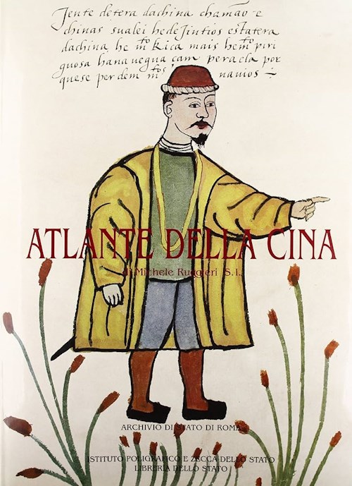 |
| Author | Istituto poligrafico e Zecca dello Stato (Italy)Mignini, Filippo |
| Place | Roma |
| Publisher | Libreria dello Stato |
| Collection | Ricci Institute Library |
| Language | Italian, Chinese |
| Type | Atlas |
| Shelf | Seminar Room 102-103 |
| Call Number | G1026.R49 M5 2013 |
| Description | xxxvi, 265 p. : ill. (chiefly color), maps ; 41 cm |
| Note | La cartografia di Matteo Ricci / a cura di Filippo Mignini. Contents: Seconda Parte: Il Mappamondo 1602 (Biblioteca Apostolica Vaticana): Riproduzione e traduzione . Huang Ping e Filippo Mignini -- Note / Huang Ping e Filippo Mignini. Terza Parte: Bibliografia. Indice dei toponimi. Indice del nomi. N.B. Honil kangni yŏktae kukto chi to = Honil Gangni Yeokdae Gukdo Ji Do 혼일강리역대국도지도 [混一疆理歷代國都之圖] or more commonly, Kangnido / Gangnido 강리도 [疆理圖] ---------------------------- "Pubblicato nella prestigiosa serie della Libreria dello Stato (IPZS), La cartografia di Matteo Ricci è il quinto volume della prevista collana delle Opere di Matteo Ricci, programmate in occasione delle celebrazioni ricciane, a cui sta per seguire il sesto (Mnemotecnica occidentale) presso l’editore Quodlibet. L’opera, frutto di sei anni di lavoro, si avvale della collaborazione di dodici studiosi italiani e stranieri, esperti di storia della cartografia e specialisti di fonti ricciane. Si divide in cinque parti. L’introduzione generale, in cui l’autore ricostruisce la storia della cartografia ricciana, la formazione cartografica di Ricci, i documenti relativi all’attività cartografica emergenti dall’opera del gesuita maceratese e presenta una interpretazione complessiva del mappamondo ricciano, come “vera espressione del libro del Cielo e della Terra”. “La cartografia – afferma il prof. Mignini - era divenuta, negli intenti di Ricci e nella pratica effettiva, il principale strumento per l’introduzione del Cristianesimo in Cina”. «Ricci – scrive l’autore nell’introduzione - non nasconde mai che l’enorme diffusione della carta ne fece lo strumento di gran lunga più importante ed efficace nella strategia di “autorizzazione”, ossia di acquisizione di credito e autorità presso il mondo dei confuciani, di sfaldamento dei pregiudizi cinesi nei confronti degli stranieri, e nella dimostrazione della tesi secondo cui in Oriente e in Occidente l’umanità è guidata da una sostanziale unità di “spirito e di principi”, come scrive Li Zhizao nella sua prefazione. Tesi, queste, centrali, nella strategia comunicativa ed evangelizzatrice di Ricci». La seconda parte del volume è costituita da otto saggi che fanno il punto sulle conoscenze attuali intorno alla cartografia ricciana. Sono di John Day, Francisco Roque de Oliveira, Giorgio Mangani, Maria Antonietta Conti, Huang Shijian e Gong Yingyan tradotti da Paolo De Troia, Angelo Cattaneo, Hiro’o Aoyama e Lim Jongtae. Tre Appendici propongono documenti inediti e rari riguardanti la prima circolazione della cartografia ricciana in Cina, evidenziando il ruolo avuto da alcuni intellettuali cinesi, tra i quali Qu Taisu e Feng Yingjing. Bibliografia, indice dei toponimi e indice dei nomi completano il prestigioso volume."-- Publication announcement. |
| ISBN | 9788824010672 ; 8824010679 |
| Multimedia |  |
| Author | Harley, J. B. (John Brian)Woodward, David, 1942-2004Yee, Cordell D. K. (Yu Dingguo 余定國), 1955- |
| Place | Chicago |
| Publisher | University of Chicago Press |
| Collection | Ricci Institute Library |
| Language | English |
| Type | Book |
| Series | The history of cartography ; v. 2, bk. 2 |
| Shelf | Stacks, Seminar Room 102-103 |
| Call Number | GA201.H53 1987 v. 2, bk. 2 |
| Description | xxvii, 970 : ill., maps (some col.) ; 29 cm. |
| Note | Cartography in the traditional East and Southeast Asian societies / edited by J.B. Harley and David Woodward ; associate editor, Joseph E. Schwartzberg, assistant editor, Cordell D.K. Yee. "Volume 2, book 2, considers the cartographic traditions of China, Korea, Japan, Vietnam, Tibet, Burma, Thailand, Laos, Malaysia, Indonesia, Brunei, and the Philippines, presenting significant new research and interpretation of archaeological, literary, and graphic sources"--pub. desc. |
| ISBN | 0226316378 ; 9780226316376 |
| LCCN | 98137677 |
| Author | Chang, Min-min [Zhou Minmin 周敏民]Hong Kong University of Science and Technology Library 香港科技大學圖書館 |
| Place | Hong Kong 香港 |
| Publisher | Hong Kong University of Science and Technology Library |
| Collection | Ricci Institute Library |
| Language | English-Chinese |
| Type | Atlas |
| Shelf | Stacks |
| Call Number | G2306.S1 C3 2003 |
| Description | 1 atlas (vii, 203 p.) : color maps ; 34 x 38 |
| Note | China in European maps : a library special collection / compiled and edited by Min-min Chang = Ditu Zhongguo : tu shu guan te cang 地圖中國 : 圖書館特藏 / bianjizhe Zhou Minmin 編輯者周敏民. "This catalog contains fifty-five maps held in the Special Collections Department of the Hong Kong University of Science and Technology Library. The collection 'vividly reflects Europe’s lasting fascination and cross-cultural exchange with China over many centuries.' Many early maps of China were based on Jesuit models, for example, plate 28 by Joan Blaeu after Martini and plate 29 by Nicolas Sanson after Ricci. |
| ISBN | 9628640399 ; 9789628640393 |
| LCCN | 2004627563 |
| Author | Morar, Florin-Stefan |
| Place | New York |
| Publisher | Cambridge University Press |
| Collection | Ricci Institute Library |
| Language | English, Chinese, Latin |
| Type | Book |
| Shelf | Seminar Room 102-103 |
| Call Number | G82.M67 2025 |
| Description | viii, 256 p. : illus. map. ; 23 cm |
| Note | Connected cartographies : world geography and the Sino-Western translation of knowledge, 1580-1842 / Florin-Stefan Morar. National University of Singapore. Includes bibliographical references and index. The lay of the land: Chinese and European world maps before the encounter -- Translation and treason: the demarcation controversy and the first translations of maps of China in Europe -- The Westerner: Matteo Ricci's world map and the quandaries about European identity in late Ming China -- Material matters: The 1603 world map by Matteo Ricci and Li Yingshi and the Manchu appropriation of Chinese and Western cartographies -- At the limits of China: translating borders between China and the West -- China's place in the world: Sino-Western maps and the transformation of Chinese cartography. "This essential history tells the fascinating story of encounters between Chinese and Western traditions of world geography and cartography. It reveals how cross-cultural exchanges shaped our understanding of the world, enriches global perspectives and highlights the importance of collaboration in knowledge creation"-- Provided by publisher. |
| ISBN | 9781009636032 |
| LCCN | 2025016153 |
| Author | Métailié, GeorgesBray, FrancescaDorofeeva-Lichtmann, Vera |
| Place | Leiden |
| Publisher | Brill |
| Collection | Ricci Institute Library |
| Language | English |
| Type | Book, Digital Book (PDF) |
| Series | Sinica Leidensia ; 79 |
| Shelf | Digital Archives, Seminar Room 102-103 |
| Call Number | T10.5.G685 2007 |
| Description | xiii, 772 p. : ill. (some col.), maps ; 25 cm. + pdf |
| Note | Graphics and text in the production of technical knowledge in China : the warp and the weft / edited by Francesca Bray, Vera Dorofeeva-Lichtmann, Georges Métailié. Introduction: The powers of 'tu' / Francesca Bray -- La représentation visuelle dans les pratiques pyro-ostéo-mantiques dans la Chine archaïque / Olivier Venture -- Placed into the right position : etymological notes on 'tu' and congeners / Wolfgang Behr -- Time, space and orientation : figurative representations of the sexagenary cycle in ancient and medieval China / Marc Kalinowski -- Communication by design : two silk manuscripts of diagrams (tu) from Mawangdui Tomb Three / Donald Harper -- Picturing or diagramming the universe / Wu Hung -- Mapless mapping : did the maps of the Shan hai jing ever exist? / Vera Dorofeeva-Lichtmann -- The tables (biao) in Sima Qian's Shi ji : rhetoric and remembrance / Griet Vankeerberghen -- The Avatamsaka-sûtra as a 'bodhi mandala text' / Hermann-Josef Röllicke -- Diagrams as an architecture by means of words : the Yanji tu / Michael Lackner -- Imagining practice : sense and sensuality in early Chinese medical illustration / Vivienne Lo -- Geometrical diagrams in traditional Chinese mathematics / Alexei Volkov -- Woodcut illustration : a general outline / Michela Bussotti -- The representation of plants : engravings and paintings / Georges Métailié -- Agricultural illustrations : blueprint or icon? / Francesca Bray -- 'Like obtaining a great treasure' : the illustrations in Song Yingxing's The Exploitation of the Works of Nature / Peter J. Golas -- Song Yingxing's illustrations of iron production / Donald B. Wagner -- The body revealed : the contribution of forensic medicine to knowledge and representation of the skeleton in China / Catherine Despeux -- New maps for the modernizing state : western cartographic knowledge and its application in 19th and 20th century China / Iwo Amelung. Link to Boston College O'Neill Library record Link to Brill eBook (BC community) Local access pdf: [Bray-Graphics and Text.pdf] This collection offers a challenging new interpretation of technical knowledge in Chinese thought and practice. Conveying technical knowledge in China through charts, plans or drawings ( tu ) dates back to antiquity. Earlier studies focused on specialised forms of tu like maps or drawings of machines. Here, however, tu is identified in Chinese terms, viz. as a philosophical category of knowledge production: visual templates for action, spanning a range from mandala to modernist mapping projects, inseparable from writing but with distinctive powers of communication. A distinction is made between two principal types of tu : ritual/symbolic and representational, highlighting essential issues such as historical shifts in their significance, the relations between tu and political power, media for inscribing tu and the impact of printing, and encounters with the West. |
| ISBN | 9789004160637 ; 9004160639 |
| LCCN | 2007038666 |
| Author | Du Halde, J.-B. (Jean-Baptiste), 1674-1743O'Malley, John W.Anville, Jean-Baptiste Bourguignon d', 1697-1782Ribeiro, Roberto M. |
| Place | Philadelphia, PA |
| Publisher | Saint Joseph's Univerity Press |
| Collection | Ricci Institute Library |
| Language | English |
| Type | Atlas, Digital Book (epub) |
| Series | Early modern Catholicism and the visual arts series ; vol. 11 |
| Shelf | Digital Archives, Seminar Room 102-103 |
| Call Number | GA1123.6.A1 J47 2014 |
| Description | 172 p. : ill., maps ; 34 cm. |
| Note | Jesuit mapmaking in China : d'Anville's "Nouvelle atlas de la Chine" (1737) / edited by Roberto M. Ribeiro with John W. O'Malley, S.J. Includes facsimile reproductions of 42 maps as found in: Nouvel atlas de la Chine, de la Tartarie chinoise, et du Thibet / par Mr. d' Anville. La Haye [The Hague, Netherlands] : Henri Scheurleer, 1737. This was a pirated edition containing re-engravings of d'Anville's maps, which were originally part of Jean-Baptiste du Halde's Description géographique, historique, chronologique, politique, et physique de l'empire de la Chine et de la Tartarie chinoise (published in Paris in 1735). Preface: Friendship and science / Roberto M. Ribeiro -- Imperial China and the Jesuit mission / R. Po-chia Hsia -- Jean-Baptiste Bourguignon d'Anville and the Nouvelle atlas de la Chine / Mario Cams -- Cartography during the times of the Kangxi Emperor: the age and the background / Han Qi -- Reproduction of the original title page and translation of the foreword of the Nouvelle atlas de la Chine -- List and order of the maps -- Facsimile of the maps. Local access only (epub): [Jesuit Mapmaking in China.epub] |
| ISBN | 9780916101817 ; 0916101819 |
| Author | Sun Zhe 孫喆, 1971- |
| Place | Beijing 北京 |
| Publisher | Zhongguo renmin daxue chubanshe 中國人民大學出版社 |
| Collection | Ricci Institute Library |
| Edition | 第1版 |
| Language | Chinese 中文[簡體] |
| Type | Book |
| Series | Qingdai jiangyu xingcheng yanjiu 清代疆域形成硏究 |
| Shelf | Stacks, Seminar Room 102-103 |
| Call Number | GA1123.6.A1 S86 2003 |
| Description | 4, iii, 279 p. : maps ; 21 cm. |
| Note | Kang Yong Qian shiqi yutu huizhi yu jiangyu xingcheng yanjiu 康雍乾時期輿圖繪制與疆域形成硏究 / Sun Zhe zhu 孫喆著. |
| ISBN | 730004624X ; 9787300046242 |
| LCCN | 2003496743 |
| Author | Batchelor, Robert K., 1968- |
| Place | Chicago |
| Publisher | University of Chicago Press |
| Collection | Ricci Institute Library |
| Language | English |
| Type | Book |
| Shelf | Seminar Room 102-103 |
| Call Number | DA681.B29 2014 |
| Description | vi, 334 p, : ill., maps ; 24 cm. |
| Note | London : the Selden Map and the making of a global city, 1549-1689 / Robert K. Batchelor.
|
| ISBN | 9780226080659 ; 022608065X |
| LCCN | 2013028618 |
| Author | Smith, Richard J. (Richard Joseph), 1944- |
| Place | New York |
| Publisher | Routledge |
| Collection | Ricci Institute Library |
| Language | English |
| Type | Digital Book (PDF) |
| Series | Critical Asian scholarship ; 9 |
| Shelf | Digital Archives |
| Call Number | GA1121.S65 2013d |
| Description | dig.pdf. [xvi, 270 p. : ill., maps ; 24 cm.] |
| Note | Mapping China and managing the world : culture, cartography and cosmology in late imperial times / Richard J. Smith. Includes bibliographical references and index. Introduction -- The languages of the Yijing and the representation of reality -- Mapping China's world : cultural cartography in late imperial China -- Ritual in Qing culture -- The teachings of ritual and the rectification of customs : echos of tradition in the political culture of modern China -- Divination in the Qing -- Jesuit interpretations of the Yijing in global perspective. Local access dig.pdf. [Smith-Mapping China.pdf] |
| ISBN | 9780203094754 |
| LCCN | 2012012457 |
| Author | Semans, Cheryl Ann |
| Place | --- |
| Publisher | --- |
| Collection | Ricci Institute Library |
| Language | English |
| Type | Thesis/Dissertation (PDF) |
| Shelf | Digital Archives |
| Call Number | GA1123.6.S46 1987d |
| Description | dig.pdf. [v, 236 p. : maps] |
| Note | Mapping the unknown : Jesuit cartography in China, 1583-1772 / by Cheryl Ann Semans. Thesis (Ph. D., Geography)--University of California, Berkeley, 1987. Includes bibliographical references (p. 219-236). Local access.[Semans - Jesuit cartography.pdf] |
| Author | Wang Qianjin 汪前進Liu Ruofang 劉若芳 |
| Place | Beijing 北京 |
| Publisher | Waiwen chubanshe 外文出版社 |
| Collection | Ricci Institute Library |
| Edition | 第1版 |
| Language | Chinese 中文[繁體] |
| Type | Atlas |
| Shelf | Stacks Oversize |
| Call Number | G2305.Q5 2007 |
| Description | 3 cases of maps ; 45 x 60 cm. |
| Note | Qingting san da shice quantu ji 清廷三大實測全圖集 / Wang Qianjin, Liu Ruofang zhengli 汪前進, 劉若芳整理. References: |
| ISBN | 9787119047225 ; 7119047221 |
| LCCN | 2007628779 |
| Author | Caboara, Marco |
| Place | Leiden |
| Publisher | Brill |
| Collection | Ricci Institute Library |
| Language | English |
| Type | Book, Digital Book (PDF) |
| Series | Explokart studies in the history of cartography ; vol.21 |
| Shelf | Digital Archives, Seminar Room 102-103 |
| Call Number | G2306.S1 C32 2022 |
| Description | 1 atlas (520 p.) : color ill., color maps ; 33 cm. + pdf |
| Note | Regnum Chinae : the printed Western maps of China to 1735 / Marco Caboara. The first European map of China faintly relied on the copy of a Chinese original, obtained through bribing and espionage; the last covered in this book was the result of the largest land survey ever made until that time. These two and another 125 maps depict, sometimes uniquely, sometimes copying each other, a country whose images were so different that it was hard to understand which to trust. China on Copperplates-銅板上的中國 西方印本中國地圖的最初一百五十年1584–1735 A summary:
Table of contents. Foreword by Prof. Wei Shyy. Foreword by Dr. Ko Pui Shuen. Acknowledgements Making and Structure of this Cartobibliography / Marco Caboara 1.1. Introduction 1.2. Chronological framework 1.3. Map groups 1.4. The introductory chapters 1.5. Jesuit cartography 1.6. A process of discovery Maps of China in the Ming-Qing Period (1534-1735) / Li Xiaocong 李孝聪 2.1. Making and Collecting Maps in Imperial China 2.2. “Maps of the whole realm” from the Ming Dynasty 2.3. “Maps of the whole realm” from the Qing Dynasty 2.4. Conclusion European Manuscript Maps of East Asia and China from Marco Polo to the Sixteenth Century / Angelo Cattaneo 3.1. Introduction 3.2. The Ancient World and the Tabula Peutingeriana 3.3. Foundations of the Medieval Cartography of Eastern Asia: The Silk Road and Its Travellers 3.4. The Catalan Atlas 3.5. Fra Mauro’s Map of the World 3.6. Henricus Martellus Germanus and the Renaissance Paradigm: Cathay and Mango beyond the Ancient Oikoumene 3.7. The New World of Martin Waldseemüller and Francesco Rosselli 3.8. Conclusions China on European Printed Maps between the Late Fifteenth and Late Sixteenth Century / Marica Milanesi 4.1. Premise 4.2. Ptolemy Replaced 4.3. Montezuma Is the Last Great Khan 4.4. From the Land Bridge to the Strait of Anián 4.5. Uncertainties 4.6. New Boundaries 4.7. Legacy China in Sixteenth-Century Portuguese Nautical Cartography / Francisco Roque de Oliveira 5.1. Methodological Backdrop 5.2. China in the Mist 5.3. Ptolemy’s Long Shadow, c.1517-1519 5.4. Cartography of Guangdong – 1520s 5.5. Around Fujian: 1530s and 1540s 5.6. The Ports of Call in Zhejiang: 1550s and 1560s 5.7. Returning to Guangdong: 1570s and 1580s 5.8. Conclusion The Coast of Guangdong and the Emergence of Macao on Chinese and Western Maps in the Sixteenth Century / Jin Guoping 金国平 6.1. Introduction 6.2. Chinese Maps 6.3. Western Maps 6.4. Conclusion Atlases of China by the Jesuits Ruggieri, Boym and Martini / Lin Hong 林宏 7.1. The Mapmakers’ Travels and an Overview of their Works 7.2. Key Reference Materials in Chinese 7.3. Basic Cartographic Methods and Processes 7.4. Conclusion Taking China’s Measure: Eighteenth-Century Empire and the Mapping of Eurasia / Mario Cams 8.1. The Qing Mapping Project and Its European Connections 8.2. Qing Court Atlases and d’Anville’s Maps of China 8.3. The Encirclement of Central Eurasia 8.4. Epilogue The Romanization of Chinese Toponyms / Emanuele Raini 9.1. Introduction 9.2. Brief Overview of the Romanization of the Chinese Language 9.3. Geographical Maps as a Source for the Study of Romanization 9.4. General Analysis of the Romanizations Employed on Maps of China 9.5. Conclusion Cartobibliography: Notes on the Use of the Cartobibliography
INDEXES Summary 摘要 Bibliography -- Libraries cited -- Alphabetical index of maps by title -- Personal names Local access dig.pdf. [Caboara-Regnum Chinae.pdf] |
| ISBN | 9789004382039 |
| LCCN | 2022585118 |
| Multimedia |  |
| Author | Bodleian LibrarySelden, John, 1584-1654 [former owner of map] Nie, Hongping Annie |
| Place | Oxford, England |
| Publisher | Bodleian Library, University of Oxford |
| Collection | Ricci Institute Library |
| Language | English |
| Type | Book |
| Shelf | Seminar Room 102-103 |
| Call Number | GA1124 1600 .S45 N54 2019 |
| Description | 74 pages : illustrations, maps (some color) ; 27 cm |
| Note | The Selden map of China : a new understanding of the Ming dynasty / Hongping Annie Nie. Includes bibliographical references (pages 66-69) and index. A discovery in the library -- A cartographic work of art -- The history of the Selden map -- Ming dynasty maritime trade -- A new understanding of the Ming dynasty. Dating from the seventeenth century at the height of the Ming Dynasty, the Selden Map of China reveals a country very different from popular conceptions of the time, looking not inward to the Asian landmass but outward to the sea. Discovered in the stacks of the Bodleian Library, this beautifully decorative map of China is in fact a seafaring chart showing Ming Dynasty trade routes. It is the earliest surviving example of Chinese merchant cartography and is evidence that Ming China was outward-looking, capitalistic and vibrant. Exploring the commercial aims of the Ming Dynasty, the port city of Quanzhou and its connections with the voyages of the early traveller Zheng He, this book describes the historical background of the era in which the map was used. It also includes an analysis of the skills and techniques involved in Chinese map-making and the significance of the compass bearings, scale and ratios found on the map, all of which combine to represent a breakthrough in cartographic techniques. The enthralling story revealed by this extraordinary artefact is central to an understanding of the long history of China's relationship with the sea and with the wider world.
|
| ISBN | 9781851245246 ; 1851245243 |
| LCCN | 2019401309 |
| Author | Jin Yingchun 金應春, 1273-1333Qiu Fuke 丘富科, fl. 1984- |
| Place | Beijing 北京 |
| Publisher | Kexue chubanshe 科學出版社 |
| Collection | Bibl. Sinensis Soc. Iesu |
| Edition | 第1版, 第1次印刷 |
| Language | Chinese 中文[簡體] |
| Type | Book |
| Shelf | Stacks |
| Call Number | GA1121.D588 J569 1984 |
| Description | v, 177 p. : ill., maps ; 19 cm. |
| Note | Zhongguo ditu shihua 中國地圖史話 / Jin Yingchun, Qiu Fuke bianzhu 金應春, 丘富科編著. |
| LCCN | 84-233974 |
| Author | Chen Zhengxiang 陳正祥, 1922- |
| Place | Xianggang 香港 |
| Publisher | Shangwu yinshuguan Xianggang fenguan 商务印書館香港分館 |
| Collection | Bibl. Sinensis Soc. Iesu |
| Language | Chinese 中文[繁體] |
| Type | Book |
| Shelf | Admin. Office |
| Call Number | GA1121.C44 1979 |
| Description | 1, 2, 72 p., [20] p. ; ill.; 22 x 28 cm. |
| Note | Zhongguo dituxue shi 中國地圖學史 / Chen Zhengxiang zhu 陳正祥著. Bibliography: p. 70-72. Includes plates of : Mawangdui Hanmu chutu ditu 馬王堆漢墓出土地圖, Yuji tu 禹跡圖, Hua Yi tu 華夷圖, Nan Song Pingjiang tu 《南宋平江圖》, Nan Song Yudi tu 南宋 《輿地圖》, Guangyu tu 《廣輿圖》, Ming Wanli Shuntian fuzhi Beijing chengtu 明萬曆 《順天府志》, Kunyu wanguo quantu 《坤輿萬國全圖》 , Da yunhe tu 大運河圖, Shancheng Chongqing Shi jietu (1886) 山城重慶市街圖, Haitang xintu - Qiantang jiangkou haitu 海塘新圖 -- 錢塘江口海圖. ***Graphic resource |
| LCCN | 79-844434 |
| Author | Lu Liangzhi 盧良志 |
| Place | Beijing 北京 |
| Publisher | Cehui chubanshe 測繪出版社 |
| Collection | Bibl. Sinensis Soc. Iesu |
| Edition | 第1版, 第1次印刷 |
| Language | Chinese 中文[簡體] |
| Type | Book |
| Shelf | Stacks |
| Call Number | GA1121.D588 L865 1984 |
| Description | vii, ii, 224 p., [2] : ill., maps ; 21 cm. |
| Note | Zhongguo dituxue shi 中國地理學史 / Lu Liangzhi bian 盧良志編. Bibliography: p. 221-224. |
| LCCN | 85-157967 |
| Author | Cao Wanru 曹婉如 |
| Place | Beijing 北京 |
| Publisher | Wenwu chubanshe 文物出版社 |
| Collection | Ricci Institute Library [M3L] |
| Edition | 第1版 |
| Language | Chinese, English |
| Type | Atlas |
| Shelf | Silver Room |
| Call Number | G2305.C93 1990 |
| Description | 1 atlas (3 v.) : maps (some color) ; 36 cm. |
| Note | Zhongguo gudai ditu ji 中國古代地圖集 / Cao Wanru [et al] bian 曹婉如 [et al] 編 = An atlas of ancient maps in China / edited by Cao Wanru [and others]. ISBNs: 7501003041 ;9787501003044 (v. 1) -- 7501007705 ; 9787501007707 (v. 2) -- 7501009546 ; 9787501009541 (v. 3) Chinese and English; essays in Chinese with English summaries. |
| ISBN | 7501003041 |
