
| Author | Ruggieri, Michele 羅明堅, 1543-1607Lo Sardo, EugenioLume, LucioArchivio di Stato di RomaIstituto poligrafico e Zecca dello Stato (Italy) |
| Place | Roma |
| Publisher | Istituto poligrafico e Zecca dello Stato |
| Collection | Ricci Institute Library |
| Language | Italian, Chinese, Latin |
| Type | Atlas |
| Shelf | Seminar Room 102-103 |
| Call Number | G2305.R84 1993 |
| Description | 1 atlas (ix, 137 p., 80 folded maps) ; 46 cm. |
| Note | Atlante della Cina / di Michele Ruggieri, S.I. ; [riproduzione in fac-simile delle tavole conservate nella Collezione Manoscritti della Biblioteca dell'Archivio di Stato di Roma], a cura di Eugenio Lo Sardo ; Archivio di Stato di Roma ; [Comitato scientifico, Lucio Lume, presidente ... et al.]. Atlante della Cina di Michele Ruggieri 羅明堅, S.J. (1543-1607) "Born in Spinazzola in Puglia (Italy), Ruggieri entered the Society of Jesus at the age of twenty-nine after holding official posts under Philip II, King of Naples. He was assigned to the Eastern missions and arrived in Goa on September 13, 1578. (Matteo Ricci was a fellow passenger). In July 1579 he arrived in Macau to implement the revolutionary missiological policy inaugurated by Alessandro Valignano 範禮安, S.J. (1538-1606). In 1583, after establishing friendly contacts with Chinese officials in Guangdong Province he was granted permission to build a church and residence at Zhaoqing 肇慶. In September of 1583 Ruggieri and Ricci took up residence there, establishing the first post-medieval Christian mission in China. |
| ISBN | 882400380X |
| Multimedia | 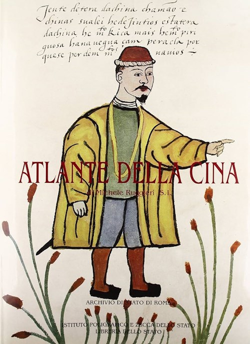 |
| Author | Chang, Min-min [Zhou Minmin 周敏民]Hong Kong University of Science and Technology Library 香港科技大學圖書館 |
| Place | Hong Kong 香港 |
| Publisher | Hong Kong University of Science and Technology Library |
| Collection | Ricci Institute Library |
| Language | English-Chinese |
| Type | Atlas |
| Shelf | Stacks |
| Call Number | G2306.S1 C3 2003 |
| Description | 1 atlas (vii, 203 p.) : color maps ; 34 x 38 |
| Note | China in European maps : a library special collection / compiled and edited by Min-min Chang = Ditu Zhongguo : tu shu guan te cang 地圖中國 : 圖書館特藏 / bianjizhe Zhou Minmin 編輯者周敏民. "This catalog contains fifty-five maps held in the Special Collections Department of the Hong Kong University of Science and Technology Library. The collection 'vividly reflects Europe’s lasting fascination and cross-cultural exchange with China over many centuries.' Many early maps of China were based on Jesuit models, for example, plate 28 by Joan Blaeu after Martini and plate 29 by Nicolas Sanson after Ricci. |
| ISBN | 9628640399 ; 9789628640393 |
| LCCN | 2004627563 |
| Author | Verbiest, Ferdinand 南懷仁, 1623-1688Walravens, Hartmut |
| Place | London |
| Publisher | Imago Mundi |
| Collection | Ricci Institute Library |
| Language | English |
| Type | Extract, Extract (PDF) |
| Shelf | Stacks, Digital Archives |
| Call Number | QB36.V46 W268 1991 |
| Description | photocopy + pdf: [p. 31-47 : maps ; 29 cm.] |
| Note | Father Verbiest's Chinese World Map (1674) /
by Hartmut Walravens. Extract: Imago Mundi 43 (1991) Includes glossary of transliterations and translations of place names from the Verbiest map; Northern Scandinavia and Russia, the Americas, West Africa, Near and Middle East. Keywords: Kunyu quantu 坤輿全圖, Jesuit maps and mapmaking, cartography, Wanguo quantu 萬國全圖, Joan Blaeu. Local access dig.pdf. [Walravens-Verbiest Imago Mundi 43.pdf] |
| Author | Library of CongressZhongyang yanjiuyuan 中央研究院 [Academia Sinica]Zhongyang yanjiuyuan Shuwei wenhua zhongxin 中央硏究院數位文化中心Ehrenberg, Ralph E., 1937-Xie Guoxing 謝國興Lin Tianren 林天人Zhang Min 張敏, 1964-Library of Congress. Geography and Map Division |
| Place | Taibei Shi 臺北市, Washington, D.C. |
| Publisher | Library of Congress |
| Collection | Ricci Institute Library |
| Language | Chinese, English |
| Type | Atlas |
| Shelf | Stacks |
| Call Number | G2306.S1 L5 2013 |
| Description | 1 atlas (444 pages) : col. maps ; 37 cm. |
| Note | Huangyu soulan : Meiguo guohui tushuguan suocang Ming-Qing yutu 皇輿搜覽 : 美國國會圖書館所藏明清輿圖 = Reading imperial cartography : Ming-Qing historical maps in the Library of Congress / [zongcehua Xie Guoxing 總策劃謝國興, Ralph E. Ehrenberg ; bianzhuan Lin Tianren ; Yingwen bianyi Zhang Min 編撰林天人 ; 英文編譯張敏]. "Published by the Academia Sinica Digital Center in association with the Library of Congress" Scale not given. Relief shown pictorially. Text in Chinese, English (中英对照) Inscribed by Ralph E. Ehrenberg. 1. 全國政區總圖 [General maps] -- 2. 地方行政區圖 [Local administrative maps] -- 3. 河運水利及河工圖 [Flood control and embankment maps] -- 4. 軍事交通圖 [Military and traffics maps] -- 5. 城市地圖 [City maps] -- 6. 邊界及周邊國家 [Political and boundary maps] -- 7. 山陵寺廟宮苑帝陵 [Maps of temples, palaces and royal gardens] -- 8. 民生经济圖 [Maps of social and economic conditions] -- 9. 複合式地圖 [Mixed-theme maps]. Publisher note:
Reading Imperial Cartography: Ming-Qing Historical Maps in the Library of Congress The bi-lingual annotated atlas contains 157 pre-1900 historical Chinese maps from the Library of Congress. The maps selected for the book are either of academic significance, made with exquisite craftsmanship or rare to be seen among the collection institutes. They are organized into 9 categories: (1) general maps (2) local administrative maps (3) flood control and embankment maps (4) military and traffics maps (5) city maps (6) political and boundary maps (7) maps of temples, palaces and royal gardens (8) maps of social and economic conditions (9) mixed-theme maps. The book is published in both in English and Chinese. The contents include preface, introduction, map descriptions, and an appendix of the historical Chinese maps collected in the Library of Congress. Each map description contains the bibliographic information, notes on the map content and a reference for relative study. Part of the Chinese maps housed in the Library of Congress used to be imperial collection, but were scattered into other countries at the end of the Qing dynasty. The publication is carried out by Academia Sinica Digital Center as a continuing effort to further expand the outcome of the Taiwan e-Learning and Digital Archives Program (TELDAP) which ended in 2012. This publication project derived from a sub-project under the "International Collaboration and Promotion of TELDAP", titled "Searching for the Qing Court Maps - The Digital Program of Seeking the Scattered Chinese Historical Cartography." |
| ISBN | 9789860393637 ; 986039363X |
| LCCN | 2014589565 |
| Author | Caboara, Marco |
| Place | Leiden |
| Publisher | Brill |
| Collection | Ricci Institute Library |
| Language | English |
| Type | Book, Digital Book (PDF) |
| Series | Explokart studies in the history of cartography ; vol.21 |
| Shelf | Digital Archives, Seminar Room 102-103 |
| Call Number | G2306.S1 C32 2022 |
| Description | 1 atlas (520 p.) : color ill., color maps ; 33 cm. + pdf |
| Note | Regnum Chinae : the printed Western maps of China to 1735 / Marco Caboara. The first European map of China faintly relied on the copy of a Chinese original, obtained through bribing and espionage; the last covered in this book was the result of the largest land survey ever made until that time. These two and another 125 maps depict, sometimes uniquely, sometimes copying each other, a country whose images were so different that it was hard to understand which to trust. China on Copperplates-銅板上的中國 西方印本中國地圖的最初一百五十年1584–1735 A summary:
Table of contents. Foreword by Prof. Wei Shyy. Foreword by Dr. Ko Pui Shuen. Acknowledgements Making and Structure of this Cartobibliography / Marco Caboara 1.1. Introduction 1.2. Chronological framework 1.3. Map groups 1.4. The introductory chapters 1.5. Jesuit cartography 1.6. A process of discovery Maps of China in the Ming-Qing Period (1534-1735) / Li Xiaocong 李孝聪 2.1. Making and Collecting Maps in Imperial China 2.2. “Maps of the whole realm” from the Ming Dynasty 2.3. “Maps of the whole realm” from the Qing Dynasty 2.4. Conclusion European Manuscript Maps of East Asia and China from Marco Polo to the Sixteenth Century / Angelo Cattaneo 3.1. Introduction 3.2. The Ancient World and the Tabula Peutingeriana 3.3. Foundations of the Medieval Cartography of Eastern Asia: The Silk Road and Its Travellers 3.4. The Catalan Atlas 3.5. Fra Mauro’s Map of the World 3.6. Henricus Martellus Germanus and the Renaissance Paradigm: Cathay and Mango beyond the Ancient Oikoumene 3.7. The New World of Martin Waldseemüller and Francesco Rosselli 3.8. Conclusions China on European Printed Maps between the Late Fifteenth and Late Sixteenth Century / Marica Milanesi 4.1. Premise 4.2. Ptolemy Replaced 4.3. Montezuma Is the Last Great Khan 4.4. From the Land Bridge to the Strait of Anián 4.5. Uncertainties 4.6. New Boundaries 4.7. Legacy China in Sixteenth-Century Portuguese Nautical Cartography / Francisco Roque de Oliveira 5.1. Methodological Backdrop 5.2. China in the Mist 5.3. Ptolemy’s Long Shadow, c.1517-1519 5.4. Cartography of Guangdong – 1520s 5.5. Around Fujian: 1530s and 1540s 5.6. The Ports of Call in Zhejiang: 1550s and 1560s 5.7. Returning to Guangdong: 1570s and 1580s 5.8. Conclusion The Coast of Guangdong and the Emergence of Macao on Chinese and Western Maps in the Sixteenth Century / Jin Guoping 金国平 6.1. Introduction 6.2. Chinese Maps 6.3. Western Maps 6.4. Conclusion Atlases of China by the Jesuits Ruggieri, Boym and Martini / Lin Hong 林宏 7.1. The Mapmakers’ Travels and an Overview of their Works 7.2. Key Reference Materials in Chinese 7.3. Basic Cartographic Methods and Processes 7.4. Conclusion Taking China’s Measure: Eighteenth-Century Empire and the Mapping of Eurasia / Mario Cams 8.1. The Qing Mapping Project and Its European Connections 8.2. Qing Court Atlases and d’Anville’s Maps of China 8.3. The Encirclement of Central Eurasia 8.4. Epilogue The Romanization of Chinese Toponyms / Emanuele Raini 9.1. Introduction 9.2. Brief Overview of the Romanization of the Chinese Language 9.3. Geographical Maps as a Source for the Study of Romanization 9.4. General Analysis of the Romanizations Employed on Maps of China 9.5. Conclusion Cartobibliography: Notes on the Use of the Cartobibliography
INDEXES Summary 摘要 Bibliography -- Libraries cited -- Alphabetical index of maps by title -- Personal names Local access dig.pdf. [Caboara-Regnum Chinae.pdf] |
| ISBN | 9789004382039 |
| LCCN | 2022585118 |
| Multimedia |  |
