
| Author | Hsieh Chiao-min [Xie Jiaomin] 謝覺民, 1921-Salter, Christopher L. |
| Place | New York |
| Publisher | McGraw-Hill |
| Collection | Ricci Institute Library |
| Language | English |
| Type | Atlas |
| Shelf | Admin. Office |
| Call Number | G2305.H753 A862 1973 |
| Description | xv, 282 p. : ill., maps ; 31 cm. |
| Note | Atlas of China / by Chiao-min Hsieh ; edited by Christopher L. Salter. Bibliography: p. 263-267. |
| ISBN | 0070306281 & 9780070306288 |
| LCCN | 72-8717 |
| Author | China Inland Mission (CIM) 內地會Stanford, Edward, 1827-1904 |
| Place | London, Philadelphia |
| Publisher | China Inland Mission ; Morgan & Scott |
| Collection | Ricci Institute Library |
| Language | English |
| Type | Atlas |
| Shelf | Rare Books, Room 103C |
| Call Number | G2305.S8 1908 |
| Description | xii, 16 p., 22 (i.e. 23) maps. ; 35 cm. |
| Note | Atlas of the Chinese empire : containing separate maps of the eighteen provinces of China proper on the scale of 1:3,000,000 and of the four great dependencies on the scale of 1:7,500,000, together with an index to all the names on the maps and a list of all Protestant mission stations, &c. / specially prepared by Mr. Edward Stanford for the China inland mission. |
| LCCN | map09-5 |
| Author | Moidrey, Joseph Tardif de 馬德賚, 1858-1937 |
| Place | Chang-hai |
| Publisher | Imprimerie de T'ou-sè-wè = Typographie de la Mission Catholique à l'Orphelinat de T'ou-sè-wè = Tushanwan yinshuguan 土山灣印書館 = T'ou-sè-wè Press |
| Collection | Rouleau Archives |
| Language | French-Chinese |
| Type | Book |
| Series | Variétés sinologiques ; 35 |
| Shelf | Rare Books, Room 103C |
| Call Number | DS703.V3 no. 35 |
| Description | [2], 16 p. : fold. maps in pocket. ; 25 cm. |
| Note | Carte des préfectures de Chine et de leur population chrétienne en 1911 = Zhongguo gefu Tianzhujiaotu 中國各府天主敎圖 / J. de Moidrey (Ma-te-lai 馬德賚). |
| Author | Sivin, Nathan |
| Place | Boston, MA |
| Publisher | Houghton Mifflin |
| Collection | Ricci Institute Library [ASCC] |
| Language | English |
| Type | Atlas |
| Shelf | Folio Cabinet 2 |
| Call Number | G2305.C986 1988 |
| Description | 1 atlas (200 p.) : col. ill., col. maps ; 31 cm. |
| Note | The Contemporary atlas of China / Nathan Sivin, consulting editor. Includes indexes. Contains maps and information on the geographical regions, history, society, and culture of China. Introduction : a chronology of China -- Maps -- Regions. Northeast China -- North China -- North-Northwest China -- Central China -- South China -- Southwest China -- Tibet and Qinghai -- Beijing -- Plant life -- Animal life -- Conservation -- History. The Great Wall -- The emperors -- Society in Imperial China -- The history of science and technology -- International contacts -- Western intrusion -- Downfall of the empire -- The rise of the Communist party -- The long march -- The life of Mao Zedong -- The Cultural Revolution -- Modern government/Deng Xiaoping Society. Population and minority nationalities -- The role of women -- Religion today -- Life in the country -- Life in the city -- Education -- Medicine and health care -- Sports and leisure -- Food and regional cooking -- Customs and festivals -- Culture. The Chinese language -- Archaeological discoveries -- Painting and ceramics -- Metalwork, jade, and sculpture -- Silk and lacquer -- Architecture and gardens China today. Natural resources -- Agriculture -- Light industry -- Heavy industry -- Developments in trade -- An expanding economy -- Transport and communications -- The army and defense -- Modern science and technology -- The visitor's China -- Hong Kong -- China's future -- The maps of China : index. |
| ISBN | 0395473292 ; 9780395473290 |
| LCCN | 88009452 |
| Author | Shao Yuechong 邵越崇 |
| Place | Shanghai 上海 |
| Publisher | Fuxing yudi xueshe 復興輿地學社 |
| Collection | Bibl. Sinensis Soc. Iesu |
| Edition | 解放新版 |
| Language | Chinese 中文[繁體] |
| Type | Atlas |
| Shelf | Seminar Room 102-103 |
| Call Number | G2305.S62 1949 |
| Description | 1 atlas (31, 25 p.) : maps ; 28 cm. |
| Note | Fuxing Zhongguo xin ditu 復興中國新地圖 / Shao Yuechong bianzhu 邵越崇編著. At head of title: 中等學校通用. Scales vary. 附解放國土面積, 人口, 城市, 鉄路統計 (1949年 6月 30日截止). |
| Author | Joüon, René 周儒望 |
| Place | Shanghai 上海 |
| Publisher | Imprimerie de T'ou-sè-wè = Typographie de la Mission Catholique à l'Orphelinat de T'ou-sè-wè = Tushanwan yinshuguan 土山灣印書館 = T'ou-sè-wè Press |
| Collection | Ricci Institute Library [AM] |
| Edition | 4e éd. |
| Language | French, Chinese |
| Type | Book |
| Shelf | Rare Books, Room 103C |
| Call Number | G2305.G68 1937 |
| Description | iv, 90 p., [47] p. of plates : ill., col. maps ; 33 cm |
| Note | Géographie commerciale de la Chine : 1937 / René Joüon 周儒望, S.J. Library copy in the AM set is bound in morocco with marbled endpapers, preserving original cardboard covers. Includes inserted truncated list from the Imprimerie de Tou-Se-Wei (map on reverse). |
| Author | Hebei sheng zhituyuan 河北省製圖院 |
| Place | Xi'an 西安 |
| Publisher | Xi'an ditu chubanshe 西安地圖出版社 |
| Collection | Ricci Institute Library [ASCC] |
| Edition | 第1版 |
| Language | Chinese 中文[簡體] |
| Type | Maps/Atlas |
| Shelf | Stacks [ASCC] |
| Call Number | G2305.H435 2009 |
| Description | 32 pp. ; maps ; 29 cm. |
| Note | Hebei sheng gonglu jiaotong dituji : Zhangjiakou fence 河北省公路交通地圖集:張家口分冊 / Hebei sheng zhituyuan 河北省製圖院. Fourth printing of 2012. |
| ISBN | 9787807484936 |
| Author | Herrmann, Albert, 1886-1945 |
| Place | Taipei 台北 |
| Publisher | Ch’eng-wen Publishing Co. 成文出版社 |
| Collection | Ricci Institute Library [ASCC] |
| Language | English |
| Type | Atlas |
| Series | Harvard-Yenching Institute monograph series ; 1 |
| Shelf | Admin. Office |
| Call Number | G2306.S1 H4 1969 |
| Description | 112 p. : color maps ; 32 cm. |
| Note | Historical and commercial atlas of China / by Albert Herrmann. Original edition published by Georg Westermann, Berlin. Includes bibliographical references (p. 85-87) and index of geographical and proper names. Maps, Plans & Diagrams -- China's Situation in the World -- Physical Geography with the Boundaries of Ancient China -- Prehistoric Sites in China -- The Beginnings of Ancient China, 1900-1300 B.C. -- China at the End of the Shang or Yin Dynasty, ca. 1110 B.C. -- Original Centre of Ancient China -- The Chou Dynasty, 11th-9th Centuries B.C. -- Ch'un-ch'iu Period, 722-481 B.C. -- The Contending States: Boundaries of 350 B.C. -- The Hsiung-nu or Huns in Central Asia, 176 and 128-36 B.C. -- The Ts'in Dynasty, 255-206 B.C. -- Economic Development Under the Earlier Han Dynasty, ca. 100 B.C. -- Lo-yang and Ch'ang-an, Ancient and Modern -- China Under the Earlier and Later Han Dynasties, 206 B.C.-220 A.D. -- China in Central Asia, 114 B.C.-127 A.D. -- The Three Kingdoms, 220-265/280 A.D. -- Asia, ca. 100 A.D. -- The Western Tsin Dynasty, 265-316 A.D. -- The Sixteen States and the Empire of the Eastern Tsin Dynasty, 317-420 A.D. -- Eastern, Central and Southern Asia, ca. 440 A.D. -- The Southern Ch'i and the Northern Wei Dynasties: Boundaries of 500 A.D. -- The Divisions of China, 535-560 A.D. -- Asia, ca. 610 A.D. -- The Sui Dynasty, 581-618 A.D. -- China in Central Asia, 660 A.D. -- Asia, ca. 750 A.D. -- The T'ang Dynasty, 618-906 A.D.: Boundaries of 700 A.D. -- The Five Dynasties, 907-960 A.D. -- The Sung, Liao and Chin Dynasties, 960-1280 A.D. -- Manchuria and Mongolia under the Liao (Kitan) Dynasty, 937-1125 A.D. -- Foreign religions in Central Asia and China up to the 14th Century A.D. -- Eastern, Central and Southern Asia, 1141 A.D. -- K'ai-fêng and Hang-chou, Ancient and Modern -- Beginnings of the Mongol Empire: Boundaries of 1234 A.D. -- Asia under the Mongols, 1290 A.D. -- The Yüan (Mongol) Dynasty, 1280-1368 A.D. -- Europe in Search of new Routes to India and China, 1486-1616 A.D. -- Asia during the Ming Dynasty: Boundaries of 1415 A.D. -- The Ming Dynasty, 1368-1644 A.D.: Boundaries of 1580 A.D. -- Peking and Nanking, Ancient and Modern -- Eastern, Central and Southern Asia, 1760 A.D. -- Chinese Turkistan, 1820 A.D. -- The Manchu Empire and the European Powers, 1644-1912 A.D. -- The Ch'ing (Manchu) Dynasty: Boundaries of 1900 A.D. -- Peiping: Tientsin, Kuan-tung, Wei-hai-wei, Kiaochou, Shanghai, Kuang-chou-wan, Canton-Macao-Hongkong -- Wu-han, Tientsin, Nanking-Shanghai, the Plain of Ch'êng-tu, Canton -- The Chinese Republic with Tibet and Mongolia: Political, Racial, and Linguistic -- Modern Northwestern China: Political -- Modern Chinese Turkistan (Hsin-Chiang): Political and Economic -- Modern Northeastern China: Political -- Modern Manchuria: Political -- Modern Manchuria and Mongolia: Economic -- Modern Southeastern China: Political -- Modern Tibet (Hsi-k'ang and Hsi-tsang): Political and Economic -- Modern Southwestern China: Political -- Modern China: Agriculture and Live Stock -- Modern China: Minerals and Mining -- Modern China: Industries -- Modern China: Traffic and Communications -- Chinese abroad, ca. 1930 A.D. |
| Author | Harvard-Yenching Institute 哈佛燕京學社Herrmann, Albert, 1886-1945 |
| Place | Cambridge, Mass. |
| Publisher | Harvard University Press |
| Collection | Bibl. Sinensis Soc. Iesu |
| Language | English, Chinese |
| Type | Atlas |
| Series | Harvard-Yenching Institute monograph series |
| Shelf | Rare Books, Room 103C |
| Call Number | G2305.H578 H377 1935 |
| Description | 112 p. : ill., maps (part col.), tables ; 34 cm. |
| Note | Historical and Commercial Atlas of China / by Albert Herrmann. Cover and spine title: Atlas of China. |
| LCCN | map37-24 |
| Author | Chevalier, Stanislas 蔡尚質, 1852-1930 |
| Place | Shanghai 上海 |
| Publisher | Xujiahui Tianzhutang 徐家匯天主堂 |
| Collection | Rouleau Archives |
| Language | Chinese 中文[繁體] |
| Type | Map |
| Shelf | Rare Books, Room 103C |
| Call Number | G7820 1887 |
| Description | color map ; 130 x 122 cm. |
| Note | Huangchao zhisheng diyu quantu 皇朝直省地輿全圖 / Cai Shangzhi huizhi 蔡尚質繪製. Shows administrative divisions of Qing Empire. Also shows the coasts and an area between the eastern parts of the Jiayuguan Pass and Tibet. Title supplied. Hand colored. Relief shown by hachures and shading. Imprint stamped on. Prime meridian: Beijing. Scale ca. 1:2,200,000. Includes text, location map, and inset of Xinjiang Sheng area. Based on map made in 1711 by a group of Catholic missionaries. Published: Guangxu dinghai 光緒丁亥 [1887] |
| ISBN | 6945123 |
| Author | Tianyu beidou 天域北斗 |
| Place | Beijing 北京 |
| Publisher | Zhongguo ditu chubanshe 中國地圖出版社 |
| Collection | Ricci Institute Library [ASCC] |
| Edition | 第1版 |
| Language | Chinese 中文[簡體] |
| Type | Maps/Atlas |
| Series | Zhongguo gonglu licheng ditu fen ce xilie 中國公路里程地圖分冊系列 |
| Shelf | Stacks [ASCC] |
| Call Number | G2305.T536 2012a |
| Description | 49 pp. ; maps and color illus. ; 29 cm. |
| Note | Jiangxi ji zhoubian shengqu gonglu licheng dituce 江西及周邊省區公路里程地圖冊 / Tianyu beidou 天域北斗. |
| ISBN | 9787503163289 |
| Multimedia | 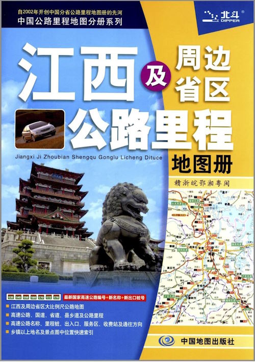 |
| Author | Liu Baohua 劉保華Gao Zhenhua 高振華Jiangxi sheng cehui dili xinxiju 江西省測繪地理信息局 |
| Place | Beijing 北京, Shanghai 上海 |
| Publisher | Zhongguo ditu chubanshe 中國地圖出版社, Zhonghua ditu xueshe 中華地圖學社 |
| Collection | Ricci Institute Library [ASCC] |
| Edition | 6版 |
| Language | Chinese 中文[簡體] |
| Type | Book |
| Shelf | Stacks [ASCC] |
| Call Number | G2305.H753 L583 2012 |
| Description | 156 pages ; 22 cm. |
| Note | Jiangxi sheng dituce 江西省地圖冊 / Liu Baohua 劉保華 et al. |
| ISBN | 9787800317033 ; 780031703X |
| Author | Zheng Peikai 鄭培凱Fan Jiawei 范家偉Xianggang chengshi daxue 香港城市大學. Zhongguo wenhua zhongxin 中國文化中心 |
| Place | Xianggang 香港 |
| Publisher | Xianggang chengshi daxue chubanshe 香港城市大學出版社 |
| Collection | Ricci Institute Library |
| Language | Chinese 中文[繁體] |
| Type | Book |
| Series | Zhongguo wenhua zhongxin jiangzuo xilie 中國文化中心講座系列 |
| Shelf | Stacks |
| Call Number | DS706.5 .Z5 2002 |
| Description | xx, 192 p. : ill., maps ; 21 cm. |
| Note | Lishi dili歷史地理 / zhubian Zheng Peikai 主編鄭培凱 ; zeren bianji Fan Jiawei 責任編輯范家偉 ; [Xianggang chengshi daxue Zhongguo wenhua zhongxin bian 香港城市大學中國文化中心編]. Colophon title: Historical geography (in traditional Chinese characters) Includes bibliographical references. |
| ISBN | 9629370786 |
| Author | Playfair, G. M. H. (George Macdonald Home), 1850-1917Biot, Edouard, 1803-1850 |
| Place | Taipei 台北 |
| Publisher | Chengwen chubanshe 成文出版社 |
| Collection | Bibl. Sinensis Soc. Iesu |
| Edition | 2d ed. |
| Language | English |
| Type | Book |
| Shelf | Seminar Room 102-103 |
| Call Number | DS705.P7 1967 |
| Description | xii, 582, lxxvi p. ; 25 cm. |
| Note | The Cities and towns of China : a geographical dictionary / by G.M.H. Playfair. |
| Author | Playfair, G. M. H. (George Macdonald Home), 1850-1917Biot, Edouard, 1803-1850 |
| Place | T’ai-pei 臺北 |
| Publisher | Chengwen chubanshe 成文出版社 |
| Collection | Rouleau Archives, Ricci Institute Library [JPW] |
| Edition | 2d ed. |
| Language | English |
| Type | Book |
| Shelf | Stacks, Seminar Room 102-103 |
| Call Number | DS705.P7 1968 |
| Description | xii, 582, lxxvi p. ; 25 cm. |
| Note | The Cities and towns of China : a geographical dictionary / by G.M.H. Playfair. |
| Author | Da Zhong shuju 大中書局 |
| Place | Xianggang 香港 |
| Publisher | Da Zhong shuju 大中書局 |
| Collection | Bibl. Sinensis Soc. Iesu |
| Language | Chinese 中文[繁體] |
| Type | Atlas |
| Shelf | Stacks |
| Call Number | G2305.X589 D294 |
| Description | 1 atlas (unpaged) : col., maps ; 16 cm. |
| Note | Xiuzhen Zhongguo fen sheng jingtu 袖珍中國分省精圖. 平裝本. Title: Zhongguo fen sheng jingtu 中國分省精圖. |
| Author | Xu Junming 徐俊鳴, 1910-1989 |
| Place | Guangzhou 廣州 |
| Publisher | Guoli Zhongshan daxue dilixuehui 國立中山大學地理學會 |
| Collection | Bibl. Sinensis Soc. Iesu |
| Language | Chinese 中文[繁體] |
| Type | Book |
| Shelf | Rare Book Stacks |
| Call Number | GB316.Z416 X858 1948 |
| Description | 3 v. : ill., maps, tables ; 19 cm. |
| Note | Zhanhou xin Zhongguo dili 戰後新中國地理 : [上中下冊] / Xu Junming bianzhu 徐俊鳴編著. Library has v. 1-2 only. 民國37-38 [1948-1949]. |
| Author | Han Feimu 韓非木Ge Suicheng 葛綏成, 1897-1978Yang Wenxun 楊文洵, 1880-1935Fan Zuocheng 范作乘, fl. 1924-1949 |
| Place | Shanghai 上海 |
| Publisher | Zhonghua shuju 中華書局 |
| Collection | Bibl. Sinensis Soc. Iesu |
| Edition | 再版 |
| Language | Chinese 中文[繁體] |
| Type | Book |
| Shelf | Rare Book Stacks |
| Call Number | GB316.D565 Y264 1936 |
| Description | 1 v. (various pagings) : ill., col. maps ; 23 cm. |
| Note | Zhongguo dili xinzhi 中國地理新誌 / bianzhe Yang Wenxun, Han Feimu, Ge Suicheng, Fan Zuocheng deng 編者楊文洵, 韓非木, 葛綏成, 范作乘等. Includes bibliographical references. 民國25 [1936]. |
| Author | |
| Place | Beijing 北京 |
| Publisher | Shangwu yinshuguan 商務印書館 |
| Collection | Bibl. Sinensis Soc. Iesu |
| Edition | 初版, 北京第2次印刷 |
| Language | Chinese 中文[簡體] |
| Type | Book |
| Series | Dili zhishi duwu 地理知識讀物 |
| Shelf | Stacks |
| Call Number | GB316.D565 S416 1973 |
| Description | [1], 63 p. : ill., maps ; 19 cm. |
| Note | Zhongguo dili zhishi 中國地理知識. |
| Author | Chen Zhengxiang 陳正祥, 1922- |
| Place | Xianggang 香港 |
| Publisher | Tiandi tushu youxian gongsi 天地圖書有限公司 |
| Collection | Ricci Institute Library |
| Language | Chinese-English |
| Type | Atlas |
| Shelf | Stacks |
| Call Number | G2305.D565 C436 1980 |
| Description | 326 p. : chiefly maps (some col.) ; 28 cm. |
| Note | Zhongguo dilitu ji 中國地理圖集 = A Geographical Atlas of China / Chen Zhengxiang 陳正祥. Title: A geographical atlas of China. |
| LCCN | 81-122966 |
| Author | Zhongguo ditu chubanshe 中國地圖出版社 |
| Place | Beijing 北京 |
| Publisher | Zhongguo ditu chubanshe 中國地圖出版社 |
| Collection | Ricci Institute Library |
| Edition | 第1版, 上海第1次印刷 |
| Language | Chinese 中文[簡體] |
| Type | Atlas |
| Shelf | Stacks |
| Call Number | G2305.D588 D588 1978 |
| Description | 30 p. : chiefly ill., col. maps ; 19 cm. |
| Note | Zhongguo dituce 中國地圖冊 = Zhongguo Dituce / Zhongguo ditu chubanshe bianzhi 中國地圖出版社編制. |
| Author | Shen Shi’an 申士安, fl. 1986-1994Meng Xiaohui 孟瀟卉, fl. 1986-1994Jin Fu 金符, fl. 1986-1994Zhu Daren 朱大仁, fl. 1986- |
| Place | Beijing 北京 |
| Publisher | Zhongguo ditu chubanshe 中國地圖出版社 |
| Collection | Ricci Institute Library |
| Edition | 第3版, 河北第7次印刷 |
| Language | Chinese 中文[簡體] |
| Type | Atlas |
| Shelf | Stacks |
| Call Number | G2305.F367 S436 1994 |
| Description | 1 atlas (34, 34 [i.e. 68, 68 p.) : col. maps ; 26 cm. |
| Note | Zhongguo fensheng gonglu jiaotong dituji 中國分省公路交通地圖集 = Zhongguo fen sheng gonglu jiaotong dituji / [shenjiao Shen Shi’an, Meng Xiaohui 審校申士安, 孟瀟卉 ; zhuanwen Jin Fu 撰文金符 ; chongban xiuding Zhu Daren, He Hongyan 重版修訂朱大仁, 何紅艷; Zhongguo ditu chubanshe zhubian, zhiban 中國地圖出版社主編, 製版]. Scales differ. Opposite pages bear duplicate numbering. |
| ISBN | 7503109041 |
| LCCN | 93-223328 |
| Author | Zhongguo lishi dituji bianjizu 中國歷史地圖集編輯組 |
| Place | Beijing 北京 |
| Publisher | Zhongguo ditu xueshe 中國地圖學社 |
| Collection | Ricci Institute [M3L] |
| Edition | 第1版 |
| Language | Chinese 中文[簡體] |
| Type | Atlas |
| Shelf | Silver Room |
| Call Number | G2306.S1 Z56 1974 |
| Description | 8 volumes : color maps ; 38 cm. |
| Note | Zhongguo lishi dituji 中國歷史地圖集 / Zhongguo lishi dituji bianji zubianji 中國歷史地圖集編輯組編輯. 本圖上今中國國界線是按照地圖出版社1971年出版的1:400萬《中華人民共和國地圖》繪製. Includes indexes.
Zhongguo lishi dituji 中國歷史地圖集. Vols 1-8: |
| Author | Ye Xiankai 葉顯鎧Zhou Yili 周宜立Chen Yiren 陳逸人 |
| Place | Taibei 臺北 |
| Publisher | Nanhua chubanshe 南華出版社 |
| Collection | Rouleau Archives |
| Edition | 革新版 |
| Language | Chinese 中文[繁體] |
| Type | Map |
| Shelf | File Cabinet A |
| Call Number | G2305.Z56 1971 |
| Description | 1 fold. color map ; 47 x 76 cm. |
| Note | Zhonghua Minguo ditu 中華民國地圖 / Bianzhe Ye Xiankai, Chen Yiren ; zhitu Zhou Yili 編者葉顯鎧,陳逸人 ; 製圖周宜立. "本圖呈奉內政部審查合格頒發臺地字第一八三三號地圖發行許可證書" "本社業經內政部開 ..." Publisher note: Taibei Nanhua chubanshe臺北南華出版社. (Malaysian distributor) Malaixiya zongdaili 馬來西亞總代理: Dongnan Ya wenhua dianying shiwuchu 東南亞文化電影事務處 : Di -Edarkan Oleh: Perkhidmatan Kebudayaan Asia Tenggara, Kuala Lumpur. Scale: 六百萬分之一 (5 cm.= 300 km.) Dated 民國60 [1971]. Inset maps: China (topographical) ; Asia ; Taiwan. Scales vary. |
| Author | Zhang Qiyun 張其昀, 1901-1985 |
| Place | Yangmingshan 陽明山 |
| Publisher | Guofang yanjiuyuan 國防硏究院 |
| Collection | Ricci Institute Library [ASCC] |
| Language | Chinese, English |
| Type | Atlas |
| Shelf | Stacks [JPW] |
| Call Number | G2305.Z563 1966 |
| Description | 5 v. : color maps ; 38 cm |
| Note | Zhonghua Minguo ditu ji 中華民國地圖集 = National atlas of China / Zhang Qiun zhubian 張其昀主編 ; Xu Shengmu [deng] bianzhi 徐聖謨[等]編製 ; Zhang Hui [deng] huitu 張恢[等]絵圖. v. 1. Taiwan.--v.2. Hsitsang (Tibet), Sinkiang and Mongolia.--v.3 North China.--v.4. South China.--v.5. General maps of China. |
| LCCN | map64000266 |
| Author | Zhang Qiyun 張其昀, 1901-1985 |
| Place | Yangming Shan 陽明山 |
| Publisher | Guofang yanjiuyuan 國防硏究院 |
| Collection | Ricci Institute Library [JPW] |
| Language | Chinese 中文[繁體] |
| Type | Atlas |
| Shelf | Stacks [JPW] |
| Call Number | G2305.Z563 1962 |
| Description | 5 v. bound in 1 v. : maps ; 36 cm. |
| Note | Zhonghua minguo ditu ji 中華民國地圖集 = National Atlas of China / Zhang Chi-yun [Zhang Qiyun] 張其昀 |
| Author | Tong Shiheng 童世享, b. 1882 |
| Place | Shanghai 上海 |
| Publisher | Zhong-Wai yutu ju 中外輿圖局 |
| Collection | Bibl. Sinensis Soc. Iesu |
| Edition | 訂正4版 |
| Language | Chinese 中文[繁體] |
| Type | Atlas |
| Shelf | Seminar Room 102-103 |
| Call Number | G2305.T65 1917 |
| Description | 1 atlas (2, 2, 2, [32], 54 pages) : color maps ; 37 cm |
| Note | Zhonghua Minguo xin quyu tu 中華民國新區域圖 / Tong Shiheng zhu 童世亨著. 民國四年初版 【1915】-- 民國四年增修再版 【1915】-- 民國五年增修三板 【1916】-- 訂正4版民國6 [1917] (The HathiTrust digital edition of this text is incorrectly scanned and the color maps are truncated and useless) |
| Author | Ditu chubanshe 地圖出版社 |
| Place | Beijing 北京 |
| Publisher | Xinhua shudian 新華書店 |
| Collection | Rouleau Archives |
| Language | Chinese 中文[簡體] |
| Type | Map |
| Shelf | File Cabinet A |
| Call Number | G2305.D48 1977 |
| Description | col. map ; 105 x 157 cm. ; fold. 43 x 30 cm. |
| Note | Zhonghua Renmin Gongheguo ditu 中華人民共和國地圖 / Ditu chubanshe 地圖出版社. Scale 1:8,000,000. Includes location map and inset of Islands of the South China Sea. |
| ISBN | 73692101 |
| Author | Ditu chubanshe 地圖出版社 |
| Place | Beijing 北京 |
| Publisher | Ditu chubanshe 地圖出版社 |
| Collection | Bibl. Sinensis Soc. Iesu |
| Edition | 精裝本, 第1版 |
| Language | Chinese 中文[簡體] |
| Type | Atlas |
| Shelf | Folio Cabinet 2 |
| Call Number | G2305.T418 1979 |
| Description | 1 atlas (75, 75 p.) : color maps ; 39 cm. + 1 map |
| Note | Zhonghua Renmin Gongheguo dituji 中華人民共和國地圖集 / Ditu chubanshe 地圖出版社. Opposite pages bear duplicate numbering. Scales differ. (1983 printing) "本圖上中國國界線系按照我社 1971 年出版的中華人民共和國地圖繪制"--Colophon. |
| LCCN | 81-111772 |
| Author | Ditu chubanshe 地圖出版社 |
| Place | Beijing 北京 |
| Publisher | Ditu chubanshe 地圖出版社 |
| Collection | Ricci Institute Library [M5] |
| Edition | 第1版, 縮印本 |
| Language | Chinese, Bunun |
| Type | Atlas |
| Shelf | Seminar Room 102-103 |
| Call Number | G2305.T4 1984 |
| Description | 1 atlas (75 p.) : color maps ; 27 cm. (boxed) |
| Note | Zhonghua Renmin Gongheguo dituji 中華人民共和國地圖集 / Ditu chubanshe bianzhi 地圖出版社編制. Scales differ. |
| LCCN | 86-168195 |
| Author | Ditu chubanshe 地圖出版社 |
| Place | Beijing 北京 |
| Publisher | Ditu chubanshe 地圖出版社 |
| Collection | Bibl. Sinensis Soc. Iesu |
| Edition | 第1版 |
| Language | Chinese 中文[簡體] |
| Type | Atlas |
| Shelf | Seminar Room 102-103 |
| Call Number | G2305.T398 1977 |
| Description | 169 p. : 51 color maps (part fold.) ; 27 cm |
| Note | Zhonghua Renmin Gongheguo fensheng ditu ji 中華人民共和國分省地圖集 / Ditu chubanshe 地圖出版社 [bianzhi 編制]. Table of contents and map titles also in Chinese characters. Hanyu pinyinban di 1 ban 漢語拼音版第1版. "Bentu shang Zhongguo guojie xianxi anzhao wo she 1971 nian chuban de 'Zhonghua Renmin Gongheguo ditu' huizhi 本圖上中國國界線系按照我社1971年出版的《中華人民共和國地圖》會制"-- Colophon. "Diming suoyin 地名索引" : p. 1-162 |
| LCCN | 78-837297 |
| Author | Yaguang yudi xueshe 亞光輿地學社Jin Qingyu 金擎宇, b. 1918Ling Daxia 凌大夏, fl. 1950-1951Jin Zhu’an 金竹安, fl. 1950-1952 |
| Place | Shanghai 上海 |
| Publisher | Yaguang yudi xueshe 亞光輿地學社 |
| Collection | Ricci Institute Library |
| Edition | 增訂6版 |
| Language | Chinese 中文[繁體] |
| Type | Atlas |
| Shelf | Rare Books, Room 103C |
| Call Number | G2305.R366 Y248 1952 |
| Description | 1 v. : col. maps ; 27 cm. |
| Note | Zhonghua Renmin Gongheguo fensheng ditu 中華人民共和國分省地圖 / Jin Qingyu, Ling Daxia, Jin Zhu’an bianzuan 金擎宇, 凌大夏, 金竹安編纂. |
